ELEVATE YOUR ASSET CONTROL
Geofence Management is your key to precise fleet oversight.
Precision Geographical Zoning for Tailored Fleet Oversight
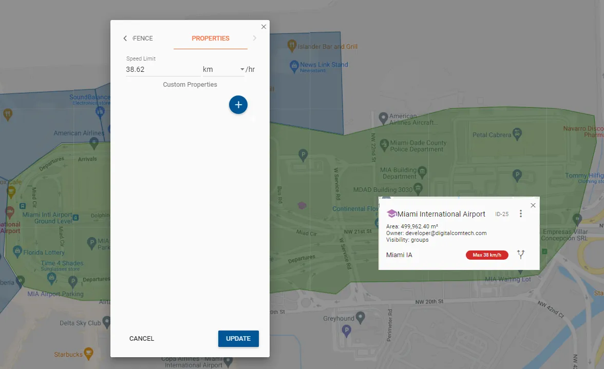
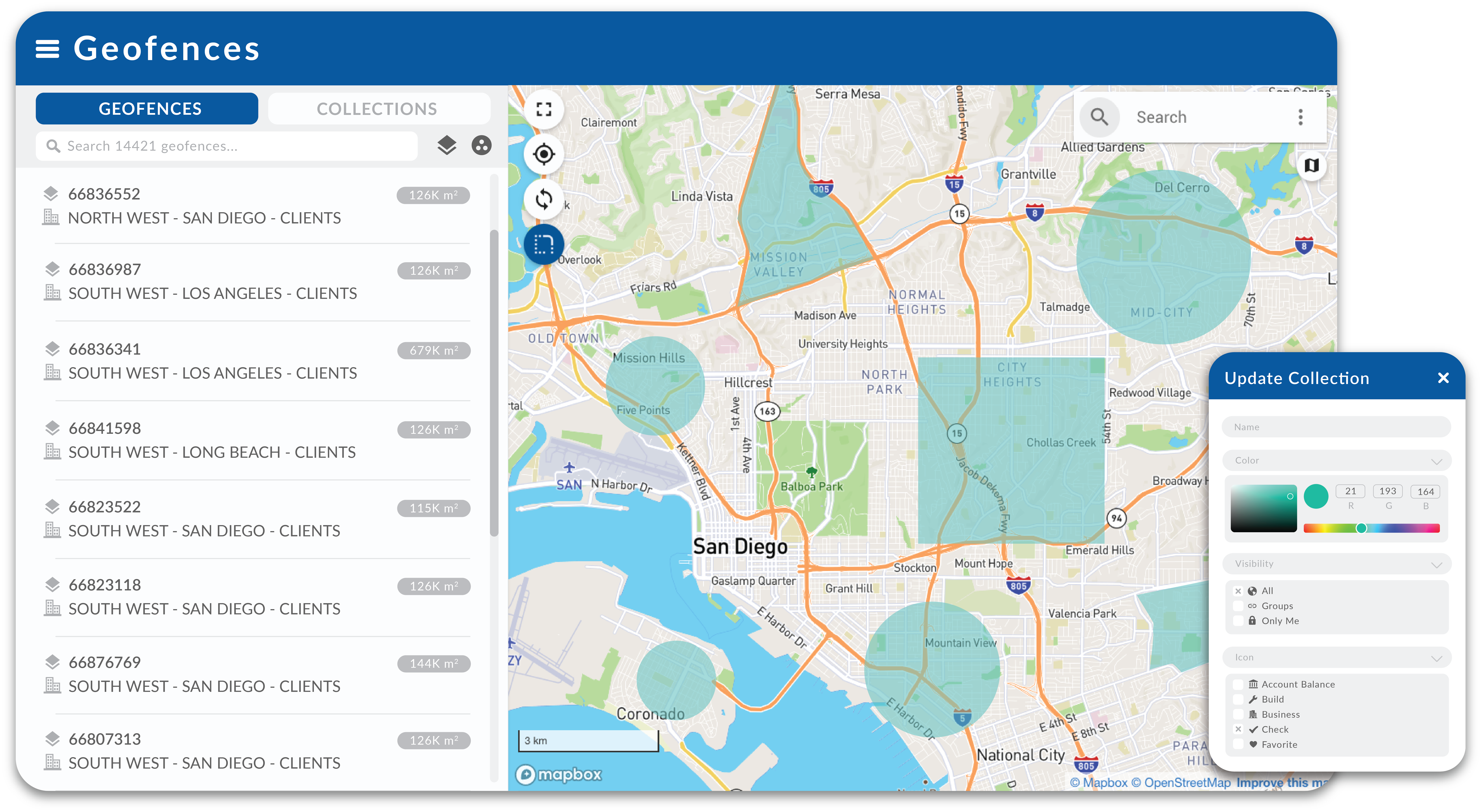
With Pegasus IoT Cloud’s Geofence Management feature, you can effortlessly create and organize geographical zones on a map.
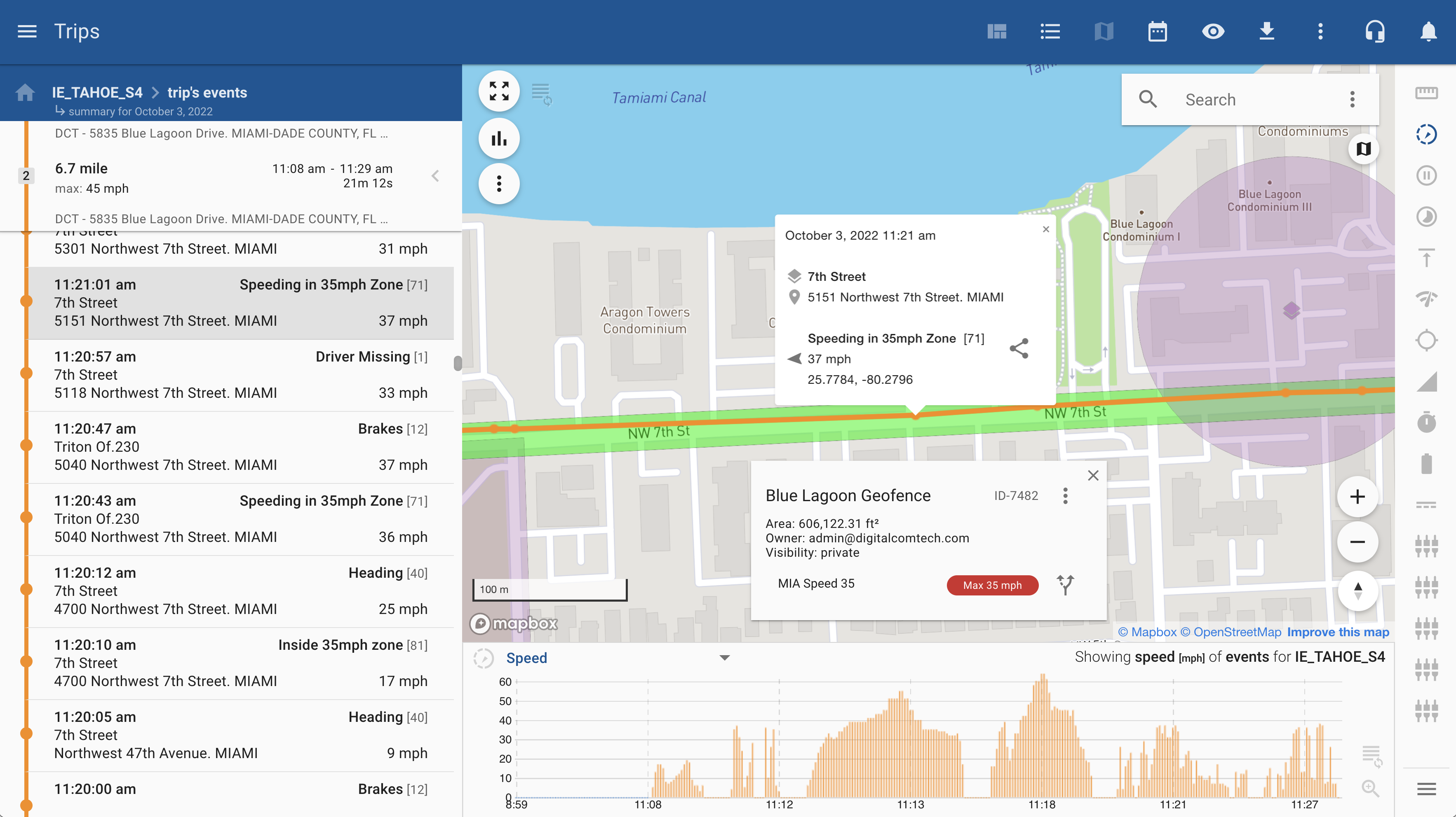
Customize zones with your choice of icons and colors, tailoring them to your fleet’s unique identity. Assign specific speed limits to each geofence, ensuring compliance with your operational requirements.
Operational Efficiency
Streamline your fleet’s operations by defining specific zones for pickups, deliveries, or service areas.
Enhanced Security
Geofences add an extra layer of security, preventing unauthorized vehicle usage and safeguarding assets.
Real-time Alerts
Receive instant notifications when your vehicles enter or exit designated geofenced areas.
Custom Visualization
Customize geofences with unique icons and colors for easy identification.
STREAMLINE GEOFENCE IDENTIFICATION WITH CUSTOM VISUALIZATION
Assign unique icons and colors to each geofence, transforming the map into an intuitive and easily interpretable tool for fleet managers.
Add a layer of clarity to your fleet oversight, facilitating quick decision-making and ensuring that your fleet operates precisely as intended.